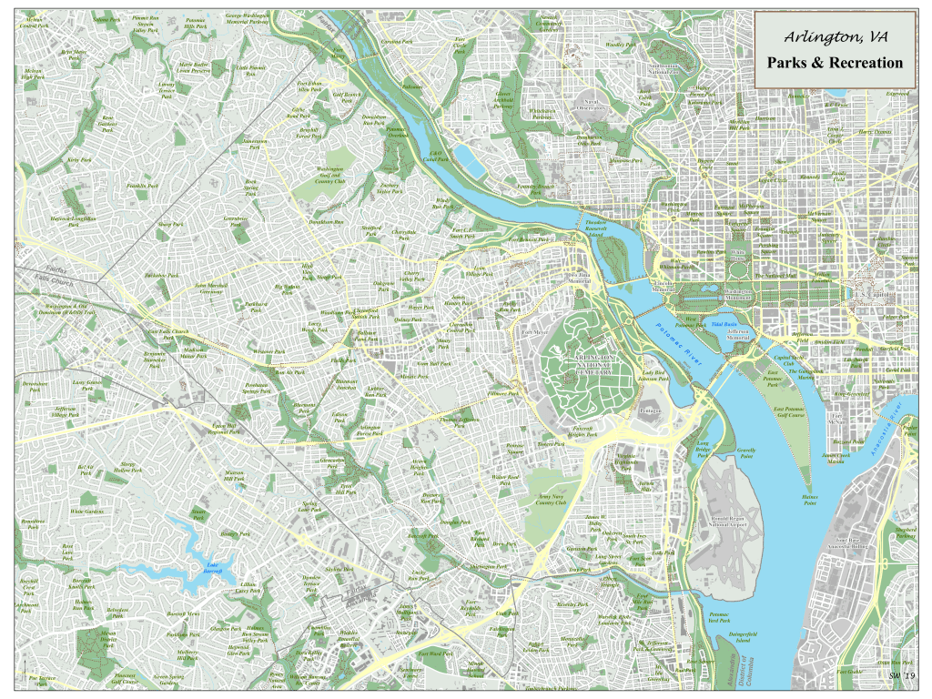
Arlington, VA – Parks & Recreation Map
This was designed as part of a hobby project to map all of the trails and parks that I enjoyed checking out while living in Arlington, VA. The Washington D.C. metro region is comprised of Arlington, the city of Alexandria, Falls Church, and portions of Maryland and offers many parks and trails.
The project involved gathering data from openstreetmap, local municipal websites hosting GIS data, and other open source sites. I utilized standard ArcGIS geoprocessing tools, Python, and SQL to create the layers and employed cartographic design techniques to create a visually appealing product.
